


Data driven innovation in coastal resilience: Cranfield at the AAAS, Seattle
03/02/2020

Plans are in place for the Cranfield input to the upcoming ‘American Association for the Advancement of Science’ (AAAS) annual conference in Seattle in February. Ron Corstanje and Stephen Hallett [Link], who are serving as the UKRI/NERC ‘Constructing a Digital Environment’ (CDE) ‘Digital Environment Champions’, have been asked to play a key role in the UKRI presence at this years AAAS conference and exhibition, one of the biggest science gatherings worldwide.
We are planning both to present a presentation workshop on ‘Data-driven Innovations in Coastal Resilience Assessment: USA and UK Perspectives’ [Link], and to host an exhibition on the UKRI stand of our research – in particular entering around our Virtual Reality big data presentation suite – configured to showcase some of our coastal research, and to be demonstrated by Cranfield’s Ian Truckell. The exhibition seeks to showcase British science and technology with a number of practical demonstrators. So in addition to the VR tools, we have been developing some Artificial Intelligence and environmental sensing demonstrators using a number of the powerful new ‘Raspberry Pi 4’ computer [Link] (Raspberry Pi itself being a great British tech company success story).
The key focus of our presentations and exhibition will be on coastal resilience, and working with colleagues from Louisiana State University to contrast some of the issues and management responses between US and UK fragile coastlines.
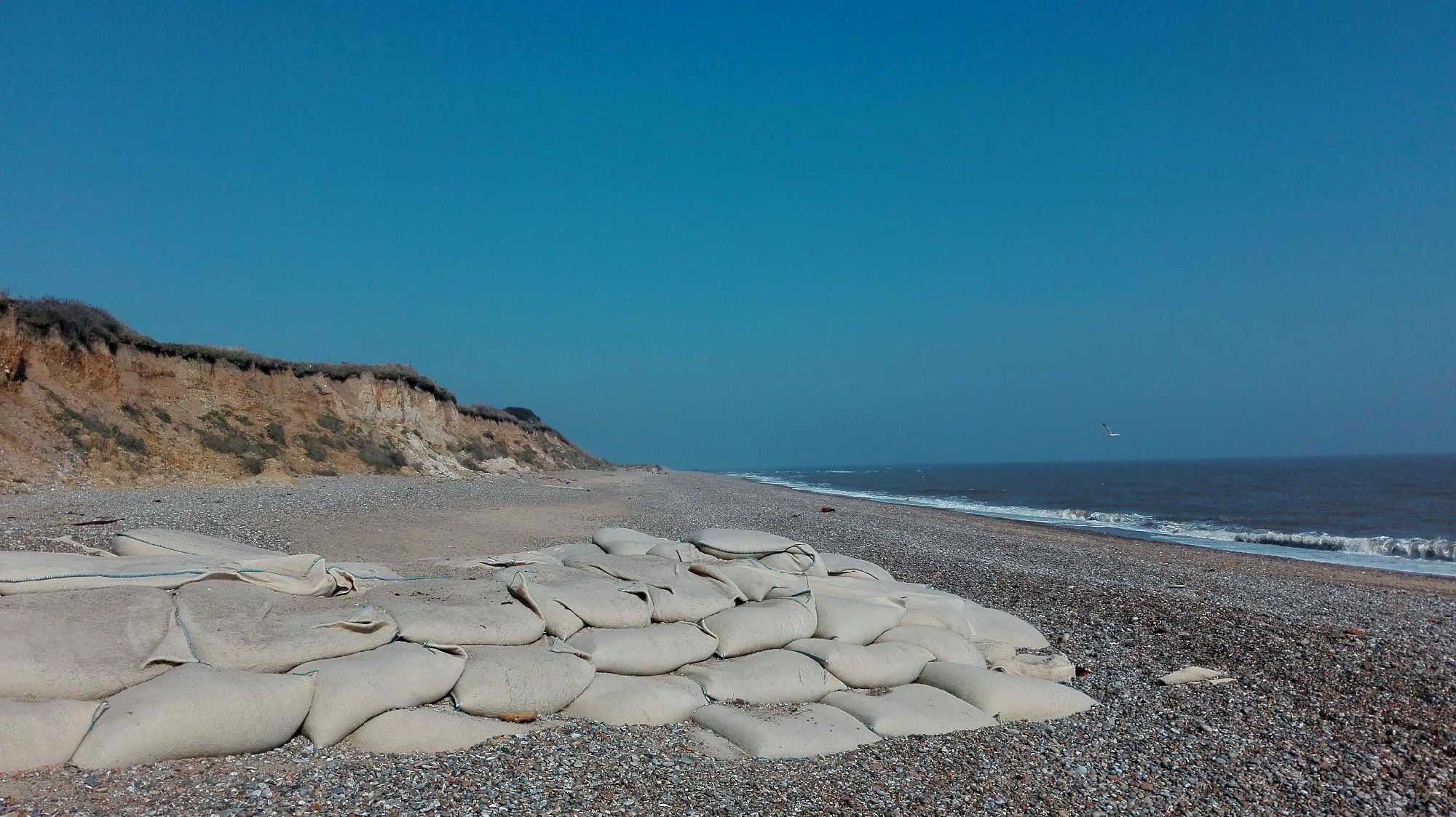
Managing our coastlines for resilience
Coastlines are one of our most dynamic environments, where the multiplicity of management options are bought into sharp focus against often rapidly changing coastal processes, and the many competing pressures. Creation of resilience in coastal areas is now widely acknowledged to be a core requirement of sustainable coastal management practices. In the UK, management of coastlines is governed through Shoreline Management Plans (SMPs), which provide a large-scale assessment of the risks associated with coastal processes, and which seek to reduce these risks to people and the developed, historic and natural environments. An SMP determines the natural forces shaping the shoreline to assess how they are likely to change over the next 100 years, taking account of the condition of existing defences. The SMP develops policies outlining how the shoreline should be managed in the future, balancing the scale of the risks with the social, environmental and financial costs involved, and avoiding adverse impacts on adjacent coastal areas.
Coastal zones attract human settlement, business and industry, and are instrumental to the functioning of societies both in coastal states and the wider global community. However, the oceans and coasts are under growing pressure as human practices change, populations rise and climate change impacts increase. In managing coastal regions, high quality data forms the basis of rational decision-making. Large volumes of ‘triple bottom line’ data exists representing a wide variety of environmental, social, and economic themes in coastal regions. Such data is especially crucial to development of environmental risk evaluations for the coast.
Decision-making and environmental management in coastal areas requires the ability to understand and quantify the variability of change and deformation of beaches and cliffs over time. An understanding of their drivers may be gained through the quantification of such changes. Today, rapidly advancing surveying technologies, capable of generating high resolution bathymetric and topographic data, allow precise measurements of geomorphological change and deformation in coastal regions, permitting great accuracy in the characterisation of volumetric change, sediment and debris flows, accumulations and erosion rates. However, such data is underutilised by coastal practitioners in their assessments of coastal change, due to a lack of awareness of the appropriate analytical techniques and the potential benefits offered by such data-driven approaches. Emergent proximal and remote sensing technologies are able to generate far higher spatio-temporal resolution measurements for coastal areas than have been previously available, in both the vertical and horizontal planes. Such methods can allow more precise measurements of coastal retreat to be undertaken than those extrapolated from traditional topographic maps or aerial photos.
Material sources:
https://doi.org/10.1016/j.ocecoaman.2019.105004
Categories & Tags:
Leave a comment on this post:
You might also like…

Using your Mendeley library after you have left Cranfield
So you have spent the whole year (or more) lovingly collecting references around the topics that matter to you and now you have a large, personalised library in Mendeley Reference Manager containing all that information. ...

Referencing the use of generative AI in your work
We recognise that Artificial Intelligence (AI) has, and will increasingly, become a part of our everyday lives and that we need to adapt to it. Hopefully you will have already seen the guidance for staff ...

Finding part-time work whilst studying at Cranfield – is it right for you?
We know that the cost of living in the UK is a real and ongoing challenge for many students. Whether you are still considering postgraduate study or already preparing for life at university, you ...

Leaving Cranfield soon? Have you heard about Alumni Library Online?
We are proud to offer one of the UK’s leading university library services for alumni. Alumni Library Online gives you instant access to thousands of top quality journal articles and the latest thinking to support ...

Want to know more about research methods?
Research methods are the strategies and tools used to gather, analyse and interpret data or evidence to uncover new information or create better understanding of a topic. Research methodology is the theory, justification and assumptions ...

Come for Cranfield, stay for Milton Keynes: how Bucks, Beds and the OxCam region are just getting started
Heard the one about the entry-level job that needed three years of experience? Sadly we all have, and that’s why in a jobs market where practical, hands-on experience is so important, study where collaboration ...
Excellent