


A sit down with Joanna Zawadzka
24/03/2021

Can you tell us a bit more about your area of research and your role at Cranfield?
I am a Research Fellow, as of recently, in Pedometrics, which is the science of the application of mathematical and statistical methods for the study of the distribution and genesis of soils. I have been involved in projects related to soil and environmental mapping and modelling using GIS and machine learning methods. Much of my time is spent on delivering on various projects, which are both industry and Research Council funded.
How long have you worked at Cranfield?
I have been working at Cranfield University for quite a while now! I started working here in 2008, so that’s 13 years already. I have been associated with Cranfield before 2008 because I was a double degree master’s student, and I did my Geographical Information Management MSc (GIM) here! The course gave me a great opportunity to explore various spatial techniques in data analysis applied to real-life problems and has sparked my interest in pursuing a career in research. I was therefore delighted to hear from the GIM course director soon after completion of my MSc inviting me to re-join Cranfield to support one of the on-going projects on a temporary basis. This temporary job soon turned into a permanent position with the Centre of Environmental and Agricultural Informatics, formerly known as the National Soils Resources Institute, and I’ve been here ever since.
I started out with a couple of large projects related to digital analysis of soil and terrain, all in the spatial domain. With time, I got really interested in ecosystem services modelling in the environmental decision making context. Ecosystem services are various benefits that people derive from nature and include soil’s capacity to filter and retain water and nutrients, vegetation’s role in safeguarding soils, insect’s role in pollination of crops, carbon sequestration in soil and biomass, and many others. As time progressed, I also realised that without a PhD, I was not able to fully develop as an academic, so in 2014 I enrolled on a part time PhD, which had to do with excess heat mitigation within urban areas through an interplay for green and blue infrastructure and spatial configuration of urban form. I completed this PhD project at the end of 2020, and all my minor corrections been finalised in January. As soon as I got my PhD title, I was quickly promoted from a Research Assistant to a Research Fellow.
Well done on your recent promotion and PhD! Where do you see your academic career going now?
I would like to have more involvement in the bidding and application process when it comes to sourcing research projects, rather than my whole focus being solely on the delivery of projects, which I enjoy very much. I would like to move into a project management role whilst also having the opportunity to drive the development of science we do.
How does your work link with industry?
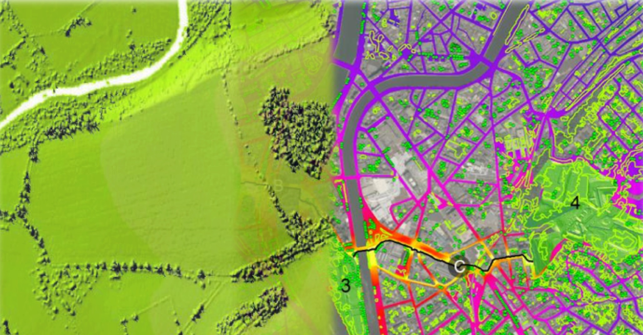
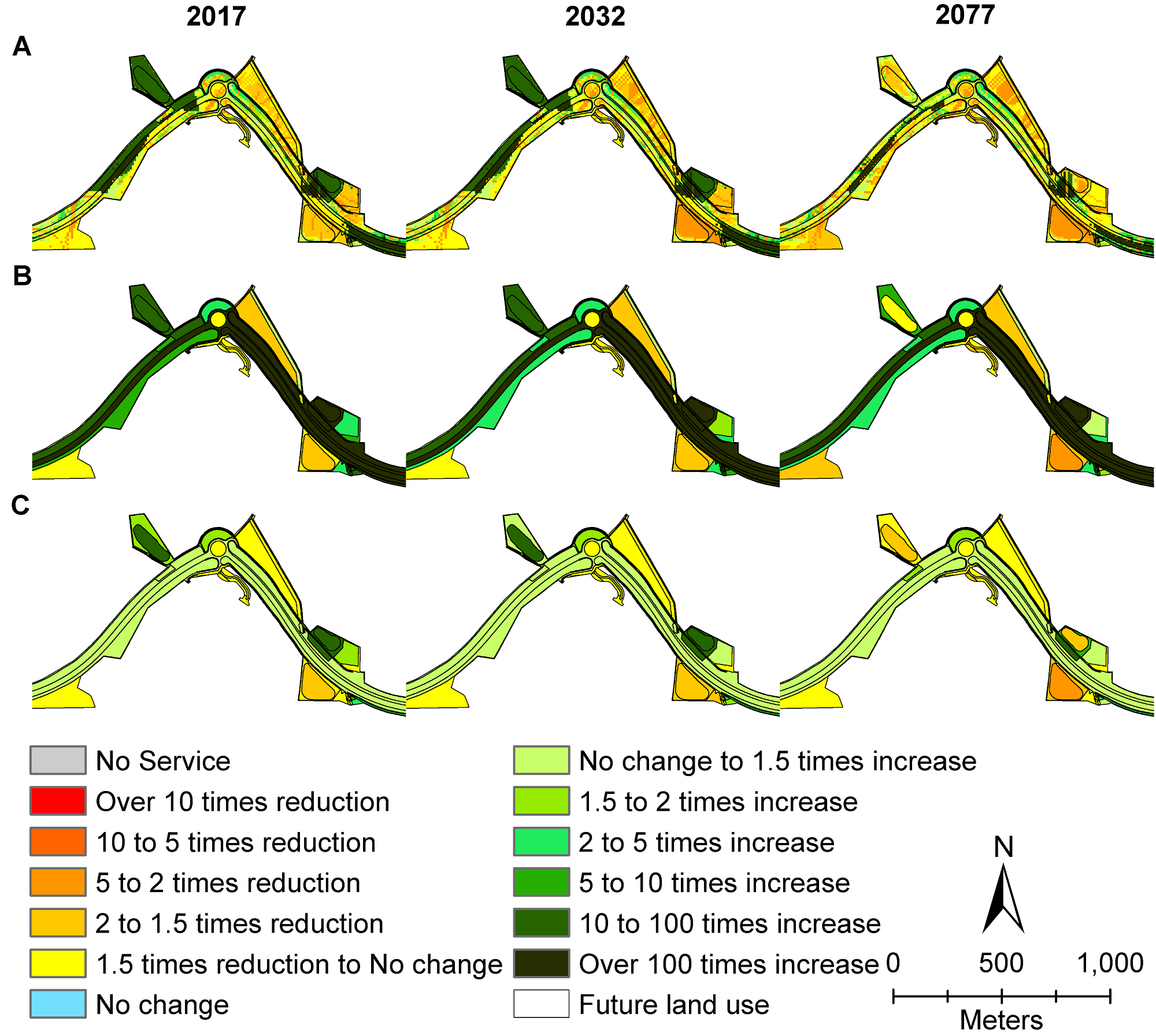
In the past, I have worked with several industrial partners. They were both large consultancies as well as smaller companies. Two of those projects where contributing to environmental statements for major road infrastructure developments, using the ecosystem services approach. For example, I have carried out a spatially-explicit ecosystem services assessment that was submitted as part of the Environment Statement for the Northern Norwich Distributor Road, in collaboration with Mott MacDonald and Norfolk County Council. This was back in 2013-14 but more recently, in 2019, I had a similar opportunity with another consultancy firm, Jacobs.
So these were both consultancy work and I was also involved in a project for a company called AgSpace Ltd. that is providing soil information and advice to farmers. This was using some spatial terrain analysis techniques to identify within-field soil variation which is crucial to farmers in terms of application of fertiliser and other soil management measures.
How do you bring students into your work?
So far, I have been involved in a bit of teaching within the Geographical Information Management course that I have graduated from! I assist students during the GIS (Geographical Information Systems) Fundamentals module when they learn about most common processes executed in the GIS using ArcGIS Pro software as an example. I also teach digital terrain analysis on the Advance GIS module, which is a prerequisite to digital soil mapping that I teach during the Environmental Resource Survey module. These only take one day from each of the modules and there are plenty more subjects covered by my colleagues! Apart from that I have also been involved in assisting MSc and PhD students in their thesis projects, especially when they have had a large spatial data analysis component.
As my role here at Cranfield progresses, I would like to get more involved in developing teaching materials around spatially-explicit ecosystem services assessments as these are becoming a standard way of assessing the environmental impact of various developments as part of the Natural Capital approach. In fact, I was involved in delivery of a bespoke workshop in ecosystem services assessments delivered to one of our industrial partners, already! I am also looking forward to starting to supervise MSc students, and eventually PhD students as well.
What do you love most about your role and what excites you about the job that you’re doing?
I really like working with spatial data and machine learning methods to generate new knowledge about the environment and as a result contribute to better-informed decision making, ensuring that decisions that we make are sustainable in the sense that they do not damage the environment or even enhance it, where possible!
What do you think the biggest challenge within your role is?
Now, it is perhaps changing my mindset from solely working on project delivery to actually trying to win and lead on projects. Two very different mindsets as well as skill sets but I’m looking forward to doing a bit of both!
Can you highlight a unique experience you’ve had, whilst working at Cranfield?
I think it would have to be the portfolio of exciting projects that I had an opportunity to contribute to during my time at Cranfield! These included applying digital soil mapping methods to generate a soil map for the Republic of Ireland at the scale of 1:250 000 (http://gis.teagasc.ie/soils/map.php) as well as assisting with research carried out for the Urban BESS project looking at ecosystem services and biodiversity of three British towns (Milton Keynes, Bedford and Luton) (https://www.cranfield.ac.uk/case-studies/research-case-studies/urban-bess). My PhD was based on very high spatial resolution elevation and land cover data captured during this project. I have also enjoyed working on EU funded projects (e.g. eSOTER, AquaNES) that allowed me to collaborate with researchers from different European countries as well as attend project meetings across Europe. A very cherished experience in the era of Zoom and Teams meetings these days!
What are you most proud of?
I think it would have to be completing my PhD and delivering on multiple other research projects at the same time!
Do you often work collaboratively with other areas of the University?
I have collaborated with colleagues in the Cranfield Water Institute on the AquaNES project. Whilst, as part of this project, I was working on the quantification of ecosystem services provided by nature-based solutions in water and wastewater treatment, colleagues in the water sciences were looking both at the social perceptibility of those solutions as well as efficiency in terms of water treatment. I have also been involved in producing ecosystem services teaching materials for the online course in Nature Based Solutions for Water and Land Management organised by Dr Gabriela Dotro who is also based in water.
If you could do an MSc at Cranfield University today, which course would you do?
I would like to explore more about what our Water Institute has to offer, especially the course in Advanced Water Management.
What is the best advice you’ve ever received?
The best advice I got was related to my PhD project. I’ve decided to follow the thesis by paper format, which is a preferred format for PhD theses at Cranfield, however, the challenge that students often face is that their papers may appear disjointed, causing potential problems during their Viva examination. The advice I’ve received from my supervisors and other colleagues was to make sure that all my papers presented as chapters in my thesis are linked together forming a clear storyline of my research. I did follow that advice, and everything went well during my Viva!
Another piece of advice from my supervisors was to enjoy my time when I am working on my PhD because afterwards I’ll be increasingly less directly involved in data analysis and that at some point in my life I would miss doing the hands-on tasks. I am yet to see whether that was a good advice!
If you could exchange roles with one person at Cranfield for the day, who it be?
I think I would like to exchange roles with any of the Heads of Centres in the Environment and Agrifood theme! This is because they get to work with multiple colleagues in the centre and have a good overview of the research they do!
Zawadzka JE, Corstanje R, Fookes J, Nichols J & Harris J (2017) Operationalizing the ecosystems approach: assessing the environmental impact of major infrastructure development, Ecological Indicators, 78, 75-84.
Categories & Tags:
Leave a comment on this post:
You might also like…
Building more than research: Reflections from the ECRn Symposium 2026
There’s something quietly powerful about a room full of early career researchers. Not just the ideas, although there were plenty of those—but the conversations, the curiosity, and the sense that everyone is figuring things ...
Library services over Easter, 3-6 April
Kings Norton Library will remain open for study 24/7. You will need your University ID card to enter the building and can use the self-service machines to borrow and return items as usual. Barrington Library ...

How do I access the full-text of Harvard Business Review (HBR)?
This is a frequently asked question, and it's worth knowing how to access this key management journal. So, how do you access HBR in full-text? The short answer is via our eJournals finder. You can find ...

Engineering problem to solve? Let Knovel help you find a solution
Did you know that Knovel provides you with more than just eBooks? Knovel is a key database for many engineering, mechanical and materials courses here at Cranfield University, and contains content from an extensive range ...
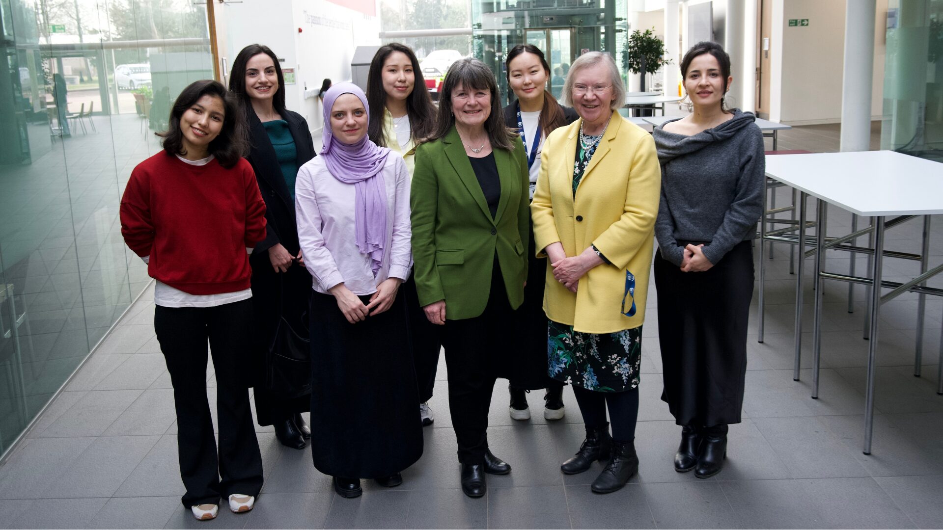
What happens when female scholars meet influential leaders?
On the 5 March 2026, our British Council Women in STEM Scholars had the privilege of sitting down with two excellent role models of industry and academia: Professor Dame Karen Holford, ...
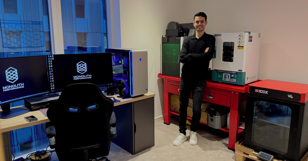
From MSc to CEO: Igniting a research revolution
For many, a master’s degree is achieving a big milestone. Kilyan Ocampo, Computational Fluid Dynamics alumni shares how studying at Cranfield helped launch his career in the energy sector. Today, Kilyan ...