Eye in the sky – using drones for environmental monitoring
09/09/2016
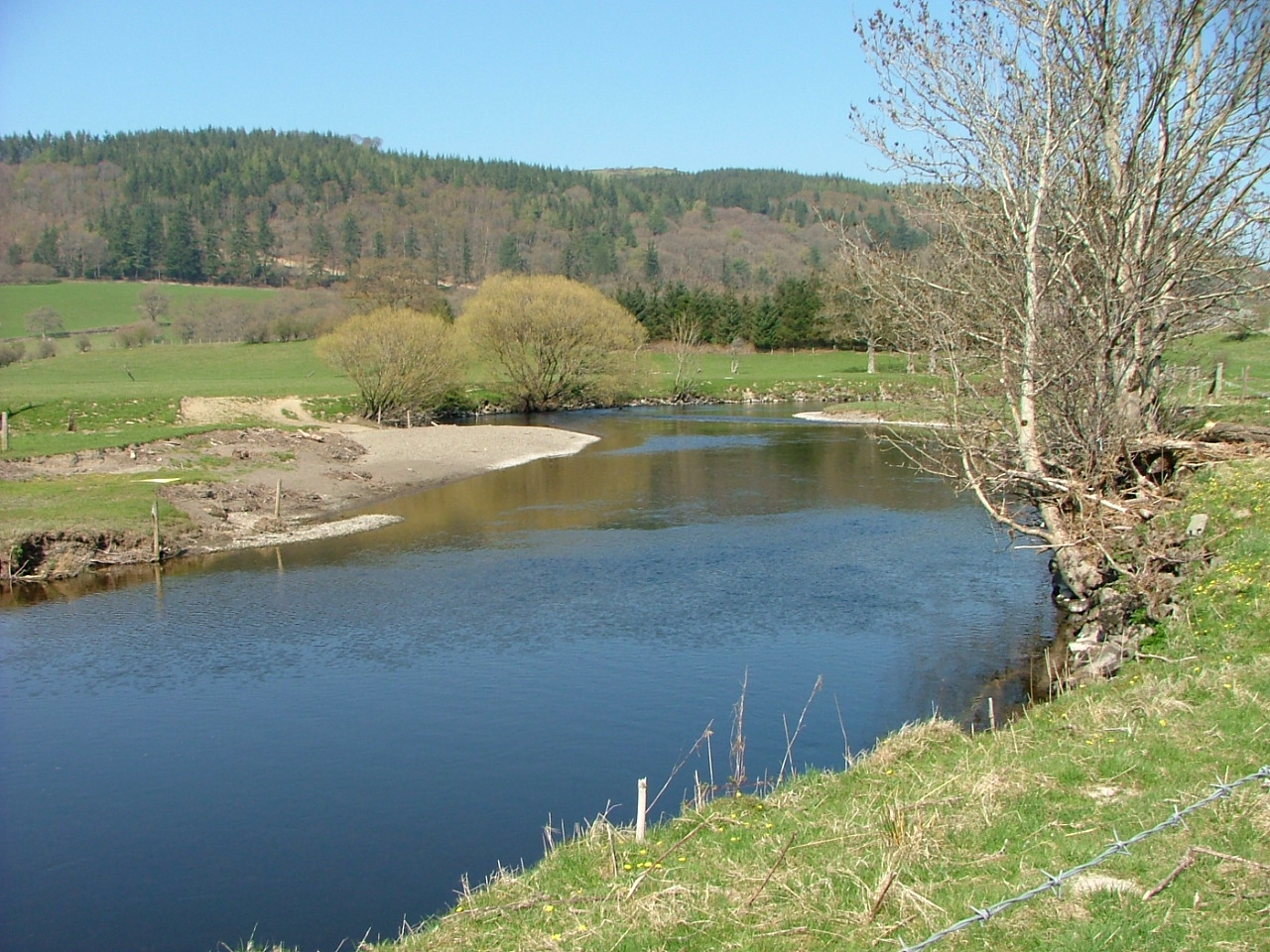
Adopted in 2000, the Water Framework Directive requires all EU member states to protect and improve the water quality in rivers, lakes, groundwater, transitional and coastal waters, and to protect against pollution and deterioration. But in order to protect and improve the water quality, we first need to assess and understand the current conditions of our rivers and waterways – which is a difficult task. Traditionally this mapping exercise would be done ‘manually’ – by someone literally walking alongside the body of water and making a visual assessment. It was clear this work needed development and the implementation of the Water Framework Directive has seen the emergence over 73 different methodologies used across EU member states. Although promising in terms of much improved ways to manage and protect our waterways, this proliferation of methods indicates a need for a more standardised approach.
Image pattern recognition techniques – taking images via Unmanned Aerial Vehicles (UAVs) – have been successfully used to map the waterways and identify certain physical features. But the accuracy and reliability of this method depends on both the quality of the aerial images and the pattern recognition technique used. Recent studies have proved the potential of UAVs to increase the quality of the imagery by capturing high resolution photography. Combine those high resolution images with Artificial Neural Networks (ANN), which are computers, designed to work like the human brain, and you have a high precision tool that can be used to automatically recognise environmental patterns.
This kind of method enables us to obtain aerial images to a resolution as small as 2.5cm, and we recently tested this along a stretch of the River Dee in Wales. This is a significant step forward as previous imagery was at a resolution of generally 12.5 cm or 25 cm. This study that I’m involved in is one of the first of this kind, looking at the development of a framework for the automated classification of all features within a river. Our initial testing proved to be accurate at 81% and enabled the identification of features at a higher level of detail than that provided by the ground truth data. For example, it allowed the separation of trees from the grass or water underneath, as well as the recognition of hydraulic units (e.g. a rippled water surface).
It’s obvious that we need to protect our rivers and waterways for the benefit of landowners, local authorities and the general population. Better ways of understanding those waterways are just a part of the process – but an important part.
If you’d like to find out more about the use of new technologies for environmental management, you might be interested in my two week UAVs for Environmental Monitoring course, or the Cranfield MSc in Environmental Risk Management.
Read also: Drones in the Cumbria skies: the floods of Christmas 2015
Categories & Tags:
Leave a comment on this post:
You might also like…
Introducing… Bloomberg Trade Flows
Are you interested in world trade flows? Would it be useful to know which nations are your country's major trading partners? If so, the Bloomberg terminal has a rather nifty function where you can view ...
Cranfield alumni voyage to the International Space Station
Seeing our alumni reach the International Space Station (ISS) has a ripple effect that extends far beyond the space sector. For school students questioning whether science is “for them”, for undergraduates weighing their next ...
From classroom to cockpit: What’s next after Cranfield
The Air Transport Management MSc isn’t just about learning theory — it’s about preparing for a career in the aviation industry. Adit shares his dream job, insights from classmates, and advice for prospective students. ...
Setting up a shared group folder in a reference manager
Many of our students are now busy working on their group projects. One easy way to share references amongst a group is to set up group folders in a reference manager like Mendeley or Zotero. ...
Company codes – CUSIP, SEDOL, ISIN…. What do they mean and how can you use them in our Library resources?
As you use our many finance resources, you will probably notice unique company identifiers which may be codes or symbols. It is worth spending some time getting to know what these are and which resources ...
Supporting careers in defence through specialist education
As a materials engineer by background, I have always been drawn to fields where technical expertise directly shapes real‑world outcomes. Few sectors exemplify this better than defence. Engineering careers in defence sit at the ...


